How Do Fire Danger Ratings Assist the Suffolk County Fire Community?
What is Fire Danger & the Fire Danger Rating Area?
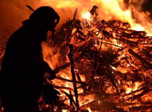
Fire Danger is a broad scale assessment and rating system that helps fire managers determine how wildfires may behave within a specific geographic area, typically 50,000 to 100,000 acres in size, such as the Central Pine Barrens region. This geographical area is referred to as a fire danger zone. Computer models are used to help predict fire behavior and its potential for occurring. The size of the fire danger zone and variances in topography, slopes, aspects, and the variety of vegetation types in the fire danger zone all affect and influence the predictions made by wildfire computer models as actual fires that occur in a specific area will behave in ways that are influenced by local conditions that the computer models cannot predict exactly. A fire danger rating does not predict the possibility of fire occurring in an area but helps predict how a fire might behave once it does start. The ignition of wildfires is almost always caused by careless or intentional actions by people, and can occur during any of the fire danger ratings.
How are Fire Danger Ratings used in Suffolk County?
Data on fire weather is an important tool for both prevention and suppression of wildfires in Suffolk County and the Central Pine Barrens. Each day, fire weather data is reviewed from a fire weather station owned and operated by the Central Pine Barrens Commission in Eastport. A daily fire danger rating is calculated from weather data using wildfire models and sent to the Suffolk County Department of Fire, Rescue and Emergency Services’ Communication Center. The Center then broadcasts the information, when the fire danger rating is moderate or above, to the volunteer fire service at approximately the same time each day to provide general information on what the potential difficulty would be to contain a fire should one ignite. In addition, the fire danger rating is transmitted by radio directly to the first responding fire chief when that chief’s fire department is activated for a grass or brush fire. This information assists the chief in determining the fire department’s plan of action (see fire danger rating and color code with description).
Follow this link to view the Daily Fire Danger Ratings for 2025.
| Rating & Color Code |
|
| Low |
Fires not likely to become serious & can be readily controlled. |
| Moderate |
Fires can start from most accidental causes, but are not likely to become serious & control is relatively easy. |
| High |
Fires start easily from all causes & may become serious with control difficult unless they are attacked successfully while still small. |
| Very High |
Fires start easily from all causes, immediately after ignition spread rapidly, quickly increase in intensity & are difficult to control. |
| Extreme |
Fires start quickly, spread furiously and burn intensely. All fires are potentially serious & difficult to control. |
What are additional ways Fire Danger Ratings are used in Suffolk County?
There are a number of other ways in which Fire Danger Ratings are used in Suffolk County. These are described below:
- Smokey Bear Informs the Public
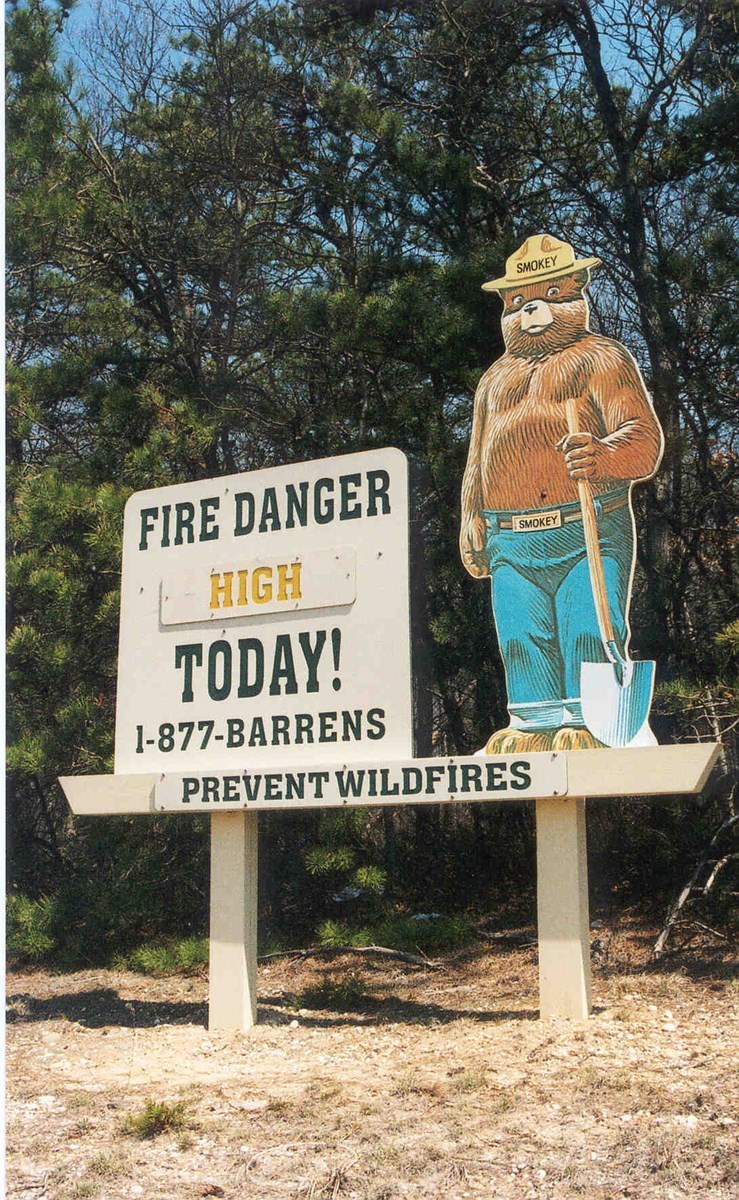
The fire danger rating is posted on Smokey Bear fire danger signs to notify the public when the fire danger rating is significant enough that special precautions must be implemented, beyond normal safeguards, to further ensure that human activities do not trigger a fire. Such precautions include restricting campfires or public access to prevent wildfires.
The weather data and fire danger rating are used by federal, state and county park officials, in coordination with other local officials, through the Wildfire Task Force’s Fire Weather Subcommittee, for making decisions about restricting or prohibiting the use of fire and other activities at parks and other public lands in the interest of public safety. A document entitled “Standard Operating Procedure for Interagency Fire Awareness Notification for Public Lands (SOP)” was prepared by the subcommittee to ensure that public land management agencies in Suffolk County simultaneously receive uniform, accurate, and timely fire awareness information impacting public lands. The SOP facilitates the coordination of consistent public land management decisions with regard to fire danger and public safety during times of high or extreme fire danger levels.
Fire suppression crews use fire weather data and fire weather forecasts to anticipate fire behavior and determine the type and amount of fire suppression forces that will be needed to achieve control of a wildfire. Since deployment of large fire suppression forces and special equipment, such as helicopters for water drops, requires additional time and money, fire weather data is helpful in quickly assessing, anticipating and ordering resource needs.
-
Additional Fire Weather Information Sources
United States Forest Service - Wildland Fire Assessment System (WFAS)
This is an internet-based information system that provides a national view of weather and fire potential, including national fire danger, weather maps and satellite-derived “Greenness” maps.
National Weather Service Fire Weather Forecast
To learn more about fire weather and fire danger ratings, contact us at firemanagement@pb.state.ny.us or call 631-288-1079.