How to identify whether a parcel is located within the Central Pine Barrens
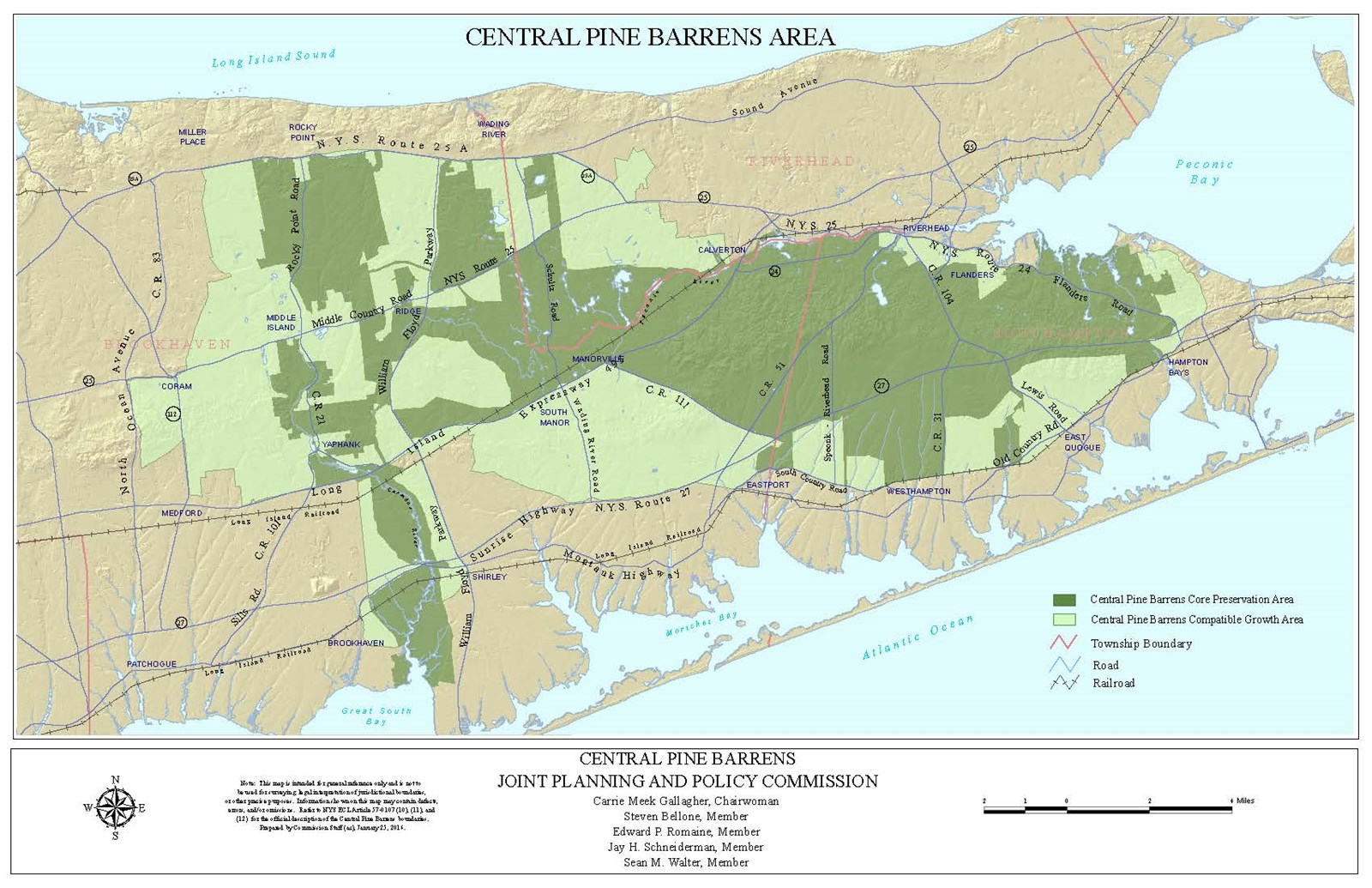
The Central Pine Barrens region is approximately 106,000 acres, and is contained within the Towns of Brookhaven, Riverhead and Southampton. The Commission's geographic jurisdiction is defined by the Central Pine Barrens boundary as described in NYS Environmental Conservation Law 57-0107(10). Any land outside of this boundary is not within the Commission's jurisdiction. The Central Pine Barrens area is further subdivided into the Compatible Growth Area (CGA) (ECL 57-0107(12)) and the Core Preservation Area (CPA) (ECL 57-0107(11)) as illustrated in the map below. It is important to note, however, that the law contains the legal boundary descriptions for these areas and should be relied upon exclusively as the definitive determinant of the boundary location as some portions of the boundaries are described in a manner that cannot physically be depicted on a map. Therefore, the Law should be referenced to verify whether or not a parcel is outside of the Central Pine Barrens or located within the CGA or CPA, rather than a map. Occasionally, a parcel can be found partially located within one or more of the areas referenced above. The Commission on occasion has issued a clarification (i.e., an interpretation) of the Core Preservation Area boundary, as defined in NY ECL 57-0107(12), that does not change a boundary but clarifies a boundary location.
Members of the public are encouraged to contact the Commission to obtain assistance with identifying whether or not a parcel is located in the Central Pine Barrens area and whether it is in the CPA or CGA by calling 631-288-1079 or by email at landuse@pb.state.ny.us. Please note that you should have your tax bill available to provide the Suffolk County Tax Map number that is assigned to the parcel. It is a four-part number with the format "District - Section - Block - Lot" as noted below for the three towns in which the Central Pine Barrens region is located.
For Brookhaven – located in the top left area of your real property tax bill
Suffolk County Tax Map Number
DISTRICT: 0200 SECTION: 5 Digit number format 000.00 BLOCK: 4 Digit number format 00.00 LOT: 6 Digit number format 000.000
For Riverhead – located in top right area of your real property tax bill
Suffolk County Tax Map Number
SWISS Code: 6 Digit Number DISTRICT: 0600 SECTION: 6 Digit number format 000.000 BLOCK: 4 Digit number format 0000 LOT: 6 Digit number 000.000
For Southampton – located in the top left area of your real property tax bill
(Note that the District Number is 0900 – since the Town does not put the
district number on the on tax bill)
Suffolk County Tax Map Number
SWIS Code: 6 Digit number SD Code: 6 Digit number SECTION: 6 Digit number format 000000 BLOCK: 4 Digit number format 0000 LOT 6 Digit Number format 000000
To learn more about the Suffolk County tax map parcel system, go to the Suffolk County Real Property Tax Service Agency (SC RPTSA) website. and look for the page containing county tax maps. The tax maps and tax parcel numbers are maintained by the SC RPTSA.