Scientific Research in the Central Pine Barrens
This page offers a sampling of some of the scientific research and projects occurring in the Central Pine Barrens. For more information about projects, feel free to contact Jason Smith, Science and Stewardship Manager. For more information, email stewardship@pb.state.ny.us or call (631) 288-1079.
Conservation Management Action Plan
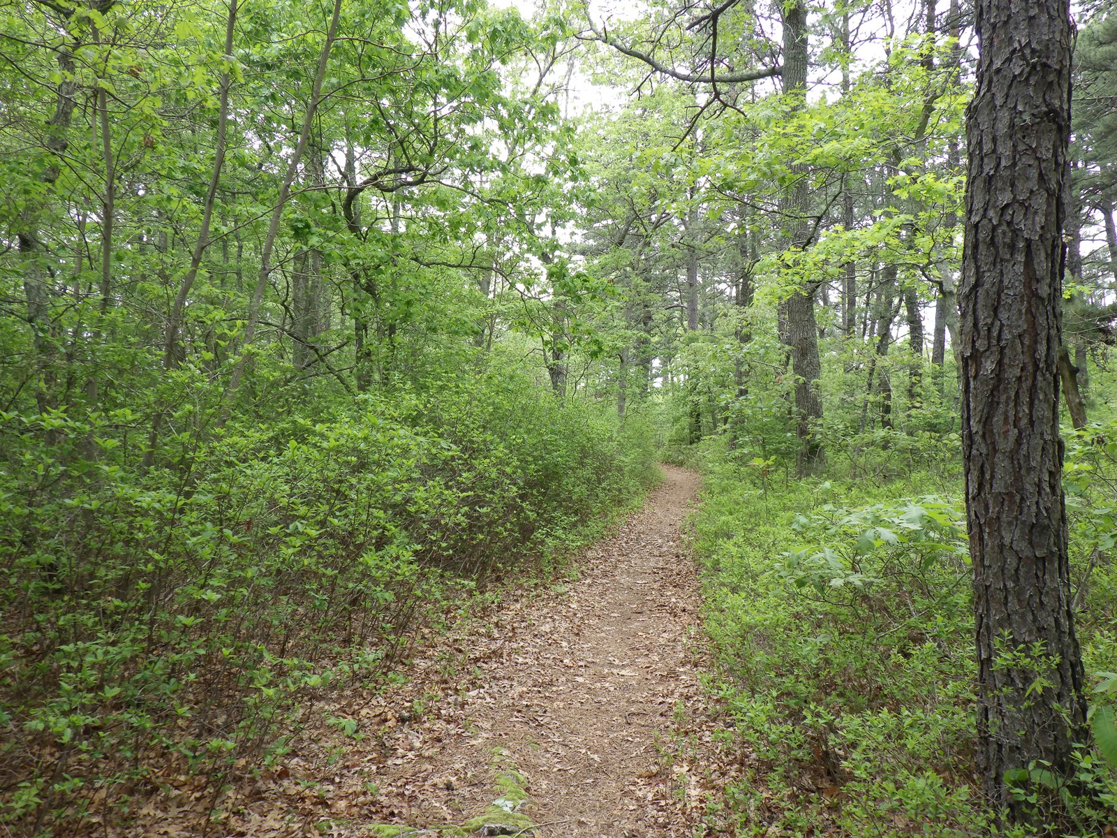
To address conservation in the Central Pine Barrens the Commission is developing a Conservation Management Action Plan. The Commission’s Conservation Management Action Plan is intended to be a holistic assessment of the environmental issues influencing the Central Pine Barrens and to provide strategic recommendations for stakeholders including academic institutions, government agencies, and non-profit organizations. The plan will highlight ongoing conservation efforts, including describing the Commission’s own efforts through its Science and Stewardship Division, and identify future projects or research that need to be initiated.
The purpose is to provide stakeholders with an overview of recent and current conservation projects being undertaken in the Central Pine Barrens and how to leverage those efforts for the future. To explain how these actions can improve our understanding of Pine Barrens ecology, which issues they address, and why the recommendations within may lead to a more resilient and sustainable Central Pine Barrens over time.
The Commission’s Conservation Management Action Plan will be an evolving document that could be revised and updated as needed.
Stay tuned for more information about this plan…
Ecological and Forest Health Monitoring
The Science and Stewardship Division has developed a robust environmental monitoring program using remote sensing technologies and survey techniques.
Remote sensing is defined as making an observation of a subject without directly interacting with the subject. Taking a photograph is an example of remote sensing. The camera’s sensor takes the picture (the observation) without directly influencing the subject being photographed.
The Science and Stewardship staff use a variety of sensors to make environmental observations. Light Detection and Ranging (or LiDAR) uses laser light to scan and record spatial measurements of environmental features. In this case, LiDAR scans are used to measure Pine Barrens vegetation including trees, shrubs, flowers and grasses. These statistical measurements are extremely accurate and can be used to describe the physical characteristics of individual plants or be combined to calculate the physical characteristics of an entire forest stand. Furthermore, these measurements can be mapped and visualized in three dimensions to further assist land managers in making conservation decisions.
LiDAR scan data can be collected from both the ground and through the air by attaching the sensor as a payload using an unmanned aircraft (aka a drone). The use of an unmanned aircraft to assist in data collection allows for additional sensors to be used. In addition to LiDAR sensors Science and Stewardship can also take photographs with a high-resolution optical camera as well as a multispectral imaging camera to collect both visual and infrared light information
The high-resolution photos captured by the optical camera also contain spatial information in addition to the color information contained in the photographic image. This allows for certain spatial measurements to be extracted from the images such as volumetric or distance calculations of the objects in the photos. Multispectral imaging takes it a step further. These sensors isolate specific wavelengths (colors) of the visual spectrum of light and only photographs that wavelength of light in relation to the subject. For example, a multispectral camera will take multiple images at the same time with each image only showing the amount of red, blue, or yellow light that is being reflected or absorbed by the subject.
The segregated color information from multispectral images can be used to automatically identify objects in the photographs. For example, which species of plant was photographed. This same information can also be used to provide insight as to the plant’s health such as if it has been infected by a disease or a pest. Over larger areas the ability to detect and identify specific species becomes invaluable. Forest characteristics can be determined from photographs alone such as stand diversity and composition, overall percent cover or percent cover by species, and if that stand is being impacted by pests, nutrient deficiencies, or drought.
In addition to the imaging capabilities of the Commission, Science and Stewardship also uses bioacoustic recorders to capture the sounds of wildlife living within the Central Pine Barrens. Recordings are analyzed to identify and catalog any wildlife species that made a sound in proximity to the recorder. This technology is used primarily to monitor habitat use by local or migrating birds that either reside or stop over in the Central Pine Barrens. Presence or absence, seasonality, and time of residency of avian species can all be determined from bioacoustic recordings. While birds may be the primary group of species documented using bioacoustic recorders, many insects, anurans (frogs), and even bats can be captured by this survey monitoring technique.
When used in conjunction, the Science and Stewardship’s remote sensing program can help answer numerous environmental questions. For example, the effectiveness of the prescribed fire program can be documented by assessing fuel types and fuel loads by surveying the structural and statistical characteristics of a forest stand or grassland before and after treatment the area has been managed with fire. Monitoring the avian response to prescribed fire management is also an indicator of the effects of prescribed fire management.
By using remote sensing survey techniques in various ways, it allows the Commission to document Central Pine Barrens’ biodiversity and reveal seasonal trends which can inform better management decisions. Over time these surveys will serve as a benchmark by which to measure changes in local conditions through either discreet disturbance events like a wildfire or connected to systemic shifts due to global climatic forces. This can be especially important when addressing conservation of local Endangered species such as Northern Long-eared and Tir-colored Bats, when documenting an infestation such as Southern Pine Beetle, or planning for community wildfire defense strategies.
Prescribed Fire Management Program
The Central Pine Barrens Prescribed Fire Management Program is a collaboration between the Commission and the New York State Department of Environmental Conservation (DEC). The Central Pine Barrens is a disturbance-dependent ecosystem in which wildfire serves as the predominant form of disturbance. The ecologic and historic role of wildfire in the Central Pine Barrens is fully described in the Central Pine Barrens Comprehensive Prescribed Fire Management Plan which was completed in 2021.
Prescribed fire is used as a management tool intended to provide a safe alternative to wildfires. The “prescription” is a pre-established set of environmental variables including weather, wind speed and direction, and local moisture levels. Once these variables are within acceptable ranges, the prescription is met and fire can be put on the ground in a safe manner to reap the benefits of fire, while reducing the risks associated with wildfire.
To assist in prescribed fire operational planning the Central Pine Barrens was delineated into five (5) Fire Management Units (FMUs); Brookhaven, Dwarf Pines, Manorville-Calverton, Rocky Point, and Southampton. Within each FMU separate burn plans are drafted for specific areas and the environmental conditions present within. This allows burn plans to be tailored to the habitat and surrounding communities that are receiving fire management.
There are several key reasons why prescribed fire management is vital to the Central Pine Barrens and the neighboring residential communities. As previously mentioned, the Pine Barrens is dependent on disturbance, especially fire, to maintain and perpetuate itself. The Pine Barrens, as we know it today, would not exist in their present state, if it were not for the extensive relationship between fire and the land. From the cultural practices of the Algonquian to the impacts of steam-powered railways fire has been a consistent part of the disturbance regime of the Pine Barrens. The ecosystem evolved with fire, and many of the floral and faunal species have adaptations for or resistances to the effects of fire.
Wildfire behavior and severity are directly associated with the amount (load) and structure of the vegetation within the system. The vegetation in the system is considered “fuel” for the wildfire. As fuel loads increase the potential for severe wildfires likewise increases. Similarly, the structure of the fuel is also important. Structure in this case means the position of the vegetation. If there are underlying grasses, shrubs, or other vegetation like vines present, it can carry a wildfire from the ground into the canopy. They are called “ladder fuels” for this very reason as they can bridge the gap between the floor and the canopy. Canopy fires are the most severe type of wildfire behavior. Prescribed fire management operations are intended to both reduce the amount of fuels present and to alter the structure of fuels (bringing them to the ground) thereby restricting wildfire behavior and reducing the potential severity of a future wildfire.
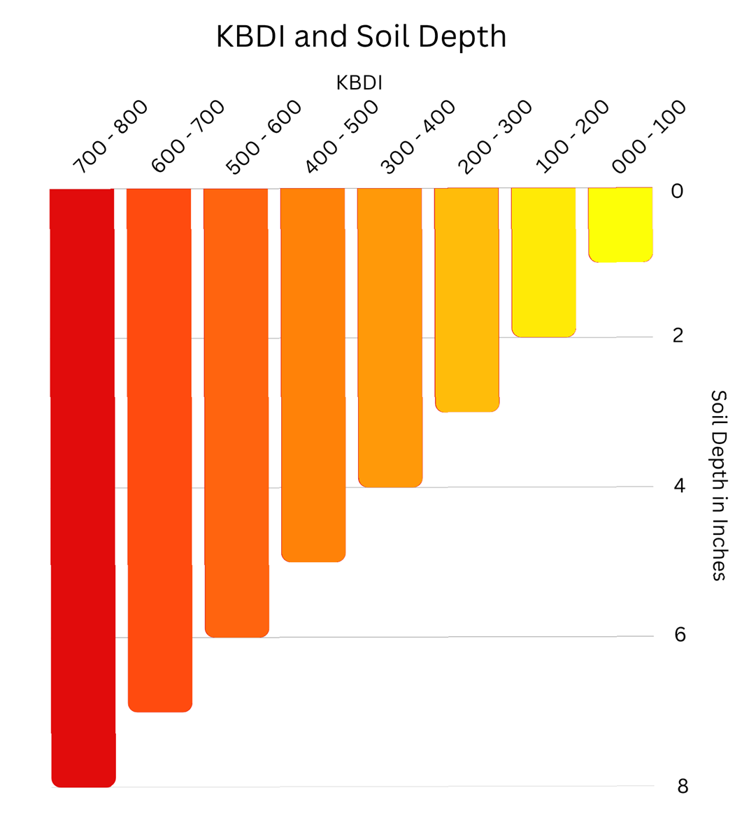
Wildfires are a climate driven event. They do not occur randomly, unless ignited by human actions, intentionally or accidentally. The weather is directly related to wildfire probability with drought conditions being one of the most predictive variables. Weather conditions are directly tied to the daily Fire Danger Ratings and moisture levels are monitored and described through measurements like the Keetch-Byram Drought Index (KBDI).
The Prescribed Fire Management Program generally runs during the Spring months (March-May) although some prescribed fire operations may occur in the fall. During the Spring fire season, the Commission hires wildland firefighters to help the DEC perform the prescribed fire management operations. Which are again, guided by the individual burn plans within a given FMU. Notifications are mailed out annually to residents and communities in proximity to locations slated to be managed that year through prescribed fire techniques.
Wildlife Road Crossing Initiative
The Central Pine Barrens Commission through the Science and Stewardship Division will be undertaking an assessment of roadways within the Pine Barrens that may be impacting nearby wildlife. The road system of Suffolk County intersects and cuts through Pine Barrens habitat fragmenting it into smaller sections. Not only do roads disrupt contiguous forest tracts, but the vehicles traveling along them are also a lethal obstacle that can prevent access to important and vital habitat features. This may include accessing habitat that is required for reproduction or reaching additional foraging or hunting areas.
Roadkill occurs on a much larger scale than what drivers can see along the edges of roadways. Many animals that are in vehicle collisions do not die immediately and succumb to their wounds some distance away from the road’s edge. All wildlife do not perceive or respond to roads in the same way either. Many animals may not even acknowledge the road at all and just try and cross it to their peril. Some animals may freeze in place and wait for the danger to pass. Others may perceive vehicles as a predator and try and out run them by darting in and out of traffic. Some animals, like birds, have trouble judging speed and instead rely on proximity to alert them to danger. At lower vehicle speeds they may have time to fly away, but at higher rates of speed the vehicle is upon them before their proximity alert goes off. Roads with heavy and frequent vehicle traffic can also be viewed as an impenetrable wall by some species, an obstacle so foreboding an attempt to navigate it is never even made.
Assisting wildlife to cross the roads of the Central Pine Barrens can help to mitigate the effects of habitat fragmentation and reduce exposure to the non-selective lethal pressures of vehicular traffic. Science and Stewardship will be working with local partners to begin to identify sections of roads where the installation of a wildlife crossing may provide tangible benefits to local species.
The Town of Brookhaven installed their first wildlife crossing on a roadway in Middle Island in 2025. The Frog Hollow Tunnel as it has become known serves as a haven for wildlife navigating the road between two vernal pools. And while the intent may have been to reduce roadkill of the amphibians using the pools for reproduction, many other species have taken to using it as well. It is a common safe space that reduces mortality and helps to mitigate habitat fragmentation
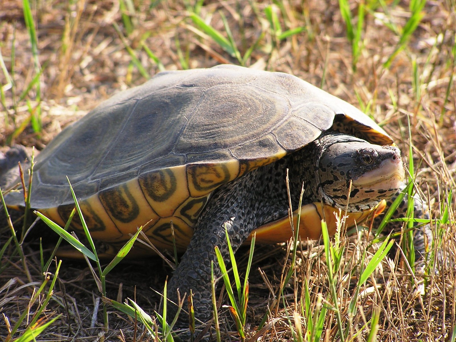
Through research, investigations, and monitoring wildlife crossing installation opportunities will be identified through a variety of methods. For example, modeling known occurrences of a target species and overlaying that information with known locations of required habitat features associated with that species’ natural history is a logical first step. The second step would be to combine that information with some site-specific surveys to better describe the exact details of the situation such as where and how to construct the crossing itself. These two steps can not only help find crossing opportunities but aid in the design of the crossing itself.